Atd UK. Administrative divisions of Great Britain
The territorial structure of the United Kingdom is unitary. Historically, the United Kingdom of Great Britain and Northern Ireland consists of four regions: England, Wales, Scotland and Northern Ireland. The country was formed around and on the basis of England, which makes up the largest part of the state both in terms of territory and population. Therefore, the other three regions, to a greater or lesser extent, have always been characterized by a desire to strengthen self-government or even separatism. However, for a long time these regions did not have their own governing bodies. In 1997 in Scotland and Wales, and in 1998 in Northern Ireland (at the same time a referendum on the same issue was held in the Irish Republic), consultative referendums were held, in which the majority of voters responded positively to the questions raised about the establishment of regional legislative and executive authorities. In 1998-1999 they were created and chosen. The Legislative Assemblies, the Scottish Parliament and the Northern Ireland Assembly were given exclusive legislative powers, i.e. the right of primary legislation in the areas of healthcare, education, local government and political-administrative division, housing and utilities, the environment, etc. The National Assembly of Wales does not have the right of primary rule-making; it has the right to regulate the listed issues only with the help of “secondary” legislation, i.e. specifying national laws.
Political-administrative division regions are different. England and Wales are divided into counties, counties in England are divided into administrative districts, and counties into communities (parishes). The counties of Wales are directly divided into communities. Northern Ireland is made up of counties, they are made up of counties, and counties are made up of communities. Scotland is territorially divided into districts consisting of communities.
Most local units have a local authority (only the counties of Northern Ireland and parishes (communities) with a population of less than 150 do not). These are, first of all, councils elected directly by the population. The term of office of councilors (members of local councils) is four years, and in Scotland it is three years. Most councils are re-elected at the same time; councils of districts of metropolitan counties (which include large cities) have 1/3 of councilors re-elected annually. Each council annually elects from among its members a chairman (in the boroughs of London and other large cities he is called the mayor, in the City - the Lord Mayor), as well as committees to which many of the powers of the council are delegated and which carry out executive activities. Hence, There are no special executive bodies of local government in the UK. There are also no officials appointed by the central government to carry out local government. The competence of local self-government bodies is traditional, but in practice difficulties arise regarding the issue of its delimitation between local government bodies of various levels.
Special status It has capital United Kingdom - London. Together with the adjacent suburbs, it forms a single conglomerate called Greater London. Traditionally it was governed by an elected Greater London Council, but it was abolished in 1985 by the Conservative government. The Labor government secured the passage of the Greater London Reconstitution Act, following a referendum on the issue in the capital in May 1998. Greater London is currently governed by a 25-member Assembly and a Mayor, elected directly by the people of the capital. Their elections took place in May 2000.
The United Kingdom also owns islands and dependent territories, which, however, are not considered part of it. Island territories - These are the Isle of Man and the English Channel islands, which have belonged to England since feudal times. They are crown possessions and are subject to the sovereignty of the United Kingdom. The islands have their own governing bodies, but the English Parliament makes laws on issues of defense, foreign relations and customs.
Dependent territories - these are former colonies of Great Britain that have retained state and legal connections with it. These are mainly small islands, for example, St. Helena, Anguilla, Bermuda, etc. Each territory has its own parliament, government and courts. But on issues of defense, foreign policy and security, laws for them are passed by the British Parliament. In each territory (as well as in the islands), there is a governor appointed by the Crown, representing the interests of the Crown and exercising control over the authorities of the territories.
Some territories have their own constitutions.
The article gives an understanding of which territories are part of Great Britain and answers the question of what causes this. The material contains interesting facts about the historical formation of the state. It becomes clear what historical period became a turning point in the development of the country, and Great Britain emerged as a well-known world power.
What parts does the United Kingdom consist of?
Great Britain is a Western European power, localized in the British Isles and separated from Europe (mainland) by the North Sea and two straits.
The United Kingdom of Great Britain includes:
- England;
- Scotland;
- Wales;
- Northern Ireland.
The latter occupies only the northern part of the island of Ireland.
The Isle of Man is located in the Irish Sea.
TOP 4 articleswho are reading along with this
The total area of the state is 244 thousand square meters. km.
The country is briefly called the United Kingdom, also Great Britain or Britain. The head of state is Queen Elizabeth II, who serves as the reigning monarch.

Rice. 1. Portrait of Queen Elizabeth II.
The United Kingdom took quite a long time to form. In the Middle Ages, on the territory of the current state there were only a number of small states-principals. In the 11th century, a feudal state with individual governance was already formed on the site of present-day Great Britain.

Rice. 2. Division of Great Britain on the map.
If we disassemble the United Kingdom of Great Britain into its “component” parts, we get the following picture: England is the historical basis of the entire kingdom; Scotland is a territory that the English have long fought for; the Principality of Wales - the original territory of residence of the Welsh; Northern Ireland is a region characterized by proactive separatist sentiments.
The Irish Republican Army operates in Northern Ireland, which has as its main goal isolation from the United Kingdom.
This gives a quick idea of how many countries there are in the UK.
Crown lands
Today, almost one and a half dozen small territories are under the sovereignty of Great Britain (14). The Queen of England is still the official ruler of the 16 states of the Commonwealth.
Britain includes the “crown lands” - the Channel Islands and the Isle of Man.
Crown lands are property of the British Crown that is not included in the United Kingdom, but is not a foreign territory. Crown lands have not had colonial status throughout their history.
Each such territory has individual license plates and a personal postal code.
For example, the Isle of Man postal service issues its own stamps, which are purchased with great pleasure by collectors and amateur philatelists.

Rice. 3. Isle of Man, postage stamps.
Some crown territories mint their own coins and issue paper money. They are not recognized as legal tender in the UK, but are often accepted as payment in many establishments in the country.
What have we learned?
We found out exactly how to understand the principle of territorial division of the United Kingdom of Great Britain. We found out which countries are directly part of Great Britain. We became familiar with the concept of “crown lands”. We received interesting information regarding these territories. They realized that formally Great Britain owns not only the territories that are part of the United Kingdom.
Test on the topic
Evaluation of the report
Average rating: 4.4. Total ratings received: 115.
One of the largest countries in Europe, Great Britain has a complex administrative-territorial division, which is based on the principles of a unitary state. The first stage of this division is the two main regions of Great Britain, otherwise called the historical provinces - Great Britain and Northern Ireland. Great Britain is divided into England, which occupies just over half the territory of the entire country, Scotland, located on one third of the state's area, and Wales, whose mountains account for only a tenth of the United Kingdom.
The further territorial division of the country looks much more complicated and represents the following system:
- In England there are 9 regions, each of which has several counties and unitary units.
- Wales includes 9 counties, three cities and a dozen county-cities.
- The structure of Scotland is the simplest, and it consists of only 32 regions.
- Northern Ireland has 6 counties and 26 districts in the lists of territorial-administrative units.
Leafing through a geographical atlas
Reading the names of the regions of Great Britain, you can come across many familiar names. For example, the city of Cambridge in the East Anglia region is a famous place where the best universities not only in the country, but throughout the Old World are concentrated. Manchester in North-West England is the birthplace of a football club that no football fan would refuse to appreciate playing on its home field.
The city of Southampton in Hampshire is famous for its preserved medieval walls made of Norman limestone, and the historical part of Scottish Edinburgh is included in the UNESCO World Heritage List as the most significant monument of ancient architecture.
Business Cards
Each of the regions of Great Britain has its own characteristics and historical attractions, and any of the four regions of the country is recognizable thanks to its own traditions in architecture, national costume and even cooking.
Scotland is an indispensable color check on kilt skirts and excellent quality whiskey. Wales can surprise even those who do not like chivalric romances, because the number and beauty of its ancient castles leave no doubt that those times and customs were wonderful. Northern Ireland captivates with its famous Irish stews and landscapes dominated by all shades of green. And finally, England will leave no doubt that unshakable traditions are not always boring, but, on the contrary, exciting, educational and interesting.
UK political maps
The administrative division of Great Britain is quite complex.
To begin with, the United Kingdom of Great Britain and Northern Ireland consists of four major administrative parts or countries: England, Northern Ireland, Wales and Scotland, united into two historical provinces: Great Britain and Northern Ireland.
Each country is in turn divided into smaller territorial units.
Thus, England is divided into 9 regions, which consist of 6 metropolitan counties (urban areas of Greater Manchester, West Yorkshire, Merseyside, Tyne and Wear, West Midlands and South Yorkshire), 28 shires (non-metropolitan counties containing several administrative districts and counties), 55 unitary units (non-metropolitan counties with no internal division into districts), Greater London and the Isles of Scilly.
Wales is divided into 22 regions, including 9 counties, 3 cities and 10 city-counties.
Scotland has been divided into 32 regions or municipalities since 1996.
Finally, the territory of Northern Ireland is divided into 26 regions, united into 6 counties.
UK political map
Which shows the division of England, Wales, Scotland and Northern Ireland into administrative units of the first and second levels.
Download a detailed political map of Great Britain. Card size 1.66 MB Download map
County map of Northern Ireland
Download the county map of Northern Ireland. Map size 251 KB Download map

Map of Northern Ireland's divisions into districts
Download the map of Northern Ireland's divisions into regions. Map size 273 KB Download map

Map of the traditional counties of Wales
Download a map of the traditional counties of Wales. Map size 117 KB Download map

Map of Scotland's divisions into regions
Download a map of Scotland's divisions into regions. Map size 93.2 KB
Great Britain is one of the largest countries of the European Union, a member of the United Nations. The capital of the country is London, the sights of which are known to every schoolchild. Previously called the British Empire.
Prominent personalities of Great Britain
It was in England that the television was invented. Great Britain is home to many outstanding people. Winston Churchill, Shakespeare, Newton, Margaret Thatcher, Paul McCartney, writer Charles Dickens, musician Freddie Mercury, the greatest physicist of our time Stephen Hawking, actress Emma Watson, Charles Darwin - the founder of the world-famous theory of evolution were born here.
What regions does Great Britain consist of?
The generally accepted administrative division of Great Britain currently includes four historical regions, or, as the British call them, countries. These include England, Wales, Scotland and Northern Ireland.
The UK has an extremely high population density: there are 230 inhabitants per 1 sq. km. At the same time, the population is distributed unevenly across the territory. Most of the British people live in this city, not surprisingly, because this territory occupies the most convenient geographical location. Also, it is in England that the political and economic center of the entire state is located. In addition, there are the most favorable natural conditions here.
The most important region
England - where most of the cultural and historical attractions of the entire Kingdom are located. For example, this is where the well-known Westminster Abbey is located. The date of its foundation is considered to be the 9th century. Buckingham Palace also gained particular fame. The royal family still lives here. The date of its construction is 1703. Every schoolchild has heard about Trafalgar Square. It is from this point that in England the distance from London to other cities is measured.
The most important district in the country
London occupies a leading position among the cities of Great Britain. In addition to the fact that London has a dominant position both politically, economically and culturally, it is the main seaport of England. Not far from the capital are the largest recreational areas in the country - the resorts of Brighton and Margate.
In addition to London, the United Kingdom of Great Britain and Northern Ireland includes other cities that serve as regional centers. There are ten in total, and this number includes Edinburgh (the capital of Scotland), Cardiff (the capital of Wales) and Belfast (the capital of Northern Ireland), Glasgow, Newcastle, Leeds and Bradford.

Scotland: nature and population
Despite the fact that the administrative division of Great Britain includes Scotland, the British often call it a separate country. The Scots are willful in everything. They have their own church, their own banks and currency. These features of Scotland date back to the times when it was still a separate state. Throughout history, England has made aggressive attempts to seize its territory.
Areas of Scotland are among the least populated. This is due to a more severe climate compared to other regions, as well as economic indicators. The capital is Edinburgh.
Scotland is the northern part of the island of Great Britain, as well as the surrounding islands. The area is 78,772 sq. km. If you compare Scotland with other territories of Great Britain, its climate is more changeable. This is due to the unevenness of the relief.
In the process of the stubborn struggle of the Scots against the conquerors, their national self-awareness grew more and more. In 1603, after the death of Queen Elizabeth I, VI ascended the throne. Then the two territories were in the possession of one monarch. In 1707, documents were signed according to which England and Scotland became a single state.

A little about Wales
The areas of Wales are located on the western side of England. In the north, its shores are washed in the south by Bristol Bay, and in the west there is St. George's Strait. Despite the fact that Wales is connected to England politically, it has retained its traditions to this day. The main and largest city in Wales is Cardiff. About 3 million people live on its territory.
Based on natural characteristics, Wales can be divided into three regions. In its central part there are mountains over 600 meters high, which cross vast valleys. Lowlands - in the coastal part. There are many river valleys along which enemy troops easily penetrated here in the past. The climate is moderate. In the elevated areas the vegetation is very sparse, but on the plains you can see many rare plant species.
Some of the most famous attractions in this district are the stalactite and stalagmite caves. Everyone who visits Wales first of all strives to visit these mysterious places. The cave called Dan Ir Ogof is attractive with stalactites and stalagmites. And in the Way of Nile cave you can admire unusual waterfalls.

Administrative divisions of Great Britain: other criteria
There are other ways to divide the country's territory, for example, into counties, as well as regions. In this case, the name of the county (in full or abbreviated) must be indicated in any mail. History has developed in such a way that modern Great Britain can be divided into several broad areas.
The administrative division of Great Britain in accordance with them is as follows:
- Northern Ireland. The capital is Belfast.
- Northern Scotland, Southern Scotland. The administrative center is Edinburgh.
- Northeast. Consists of 4 counties. The main city is Newcastle upon Time.
- North West - consists of five counties, the main cities are Liverpool and Manchester.
- Yorkshire and the Humber region. Yorkshire is the largest county in all of England. It is part of the administrative unit of Yorkshire and the Humber.
- East Midlands. The capital of the region is Nottingham.
- West Midlands with its capital in Birmingham.
- Wales.
- Eastern England, the main city of which is Cambridge.
- South-East with the administrative center in Guildford.
- Southwest. The largest population center is Bristol.
- Greater London area.
There are about a hundred large cities in Great Britain. Moreover, 44 of them have large ports. The United Kingdom of Great Britain and Northern Ireland has traded through sea routes throughout history, mainly with the Baltic countries. and Liverpool throughout history have been a kind of gateway to the “New World”.
Localities in the UK are known for their long and sometimes difficult to pronounce names. However, generally accepted toponyms are also used here. For example, Great Britain has about 1,500 settlements called Newtown.
 Get translation and transcription, pronunciation, phrases and sentences Set expressions, phrases, idioms with the verb Get
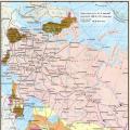 Russian Empire in the second half of the 18th century Economic policy of Catherine II
 Electrical power and electrical engineering: who to work with and what to prefer Energy and electrical engineering who to work with